-
Virtual Memorials
History in 3D
Text: Elvia Wilk
-
It doesn’t take an apocalypse to wipe out a building. Demolition happens all the time as demographics shift, economic tides ebb and flow, and varying political agendas come to the fore. Removal is often a more emphatic political tool than construction is, and demolition can be a divisive and painful process, striking at the nerve centers of cultural heritage, community unity, and spatial ownership. Whether loss results from human action or natural catastrophe, preserving the memory of a place is a complex endeavor. “History for everyone has become reduced to the evidence of a photograph,” wrote geographer David Harvey in 1989. Today, history’s representation is fleshed out far beyond the flat image – it’s become a multi-dimensional, virtual construction. Does use of digital renderings, virtual reality, and hi-tech mapping systems enrich historical memory or reduce it further? Temporary Memorial Project for Jobbers’ Canyon In 1989, 24 buildings in a district of downtown Omaha, Nebraska known as Jobbers’ Canyon were demolished to make way for ConAgra’s sprawling new executive headquarters. Occupying six city blocks along the Missouri River, the masonry and timber-frame architecture epitomized early-1900s midwestern Renaissance Revival style (yet to Charles Harper, the chief executive of ConAgra at the time, they just looked like “some big, ugly red brick buildings"). Despite protests from citizen’s groups and historic organizations, Jobbers’ Canyon was flattened in the name of economic progress –the largest site in the US National Register of Historic Places ever lost. Artist Nicholas O’Brien has digitally re-composed ten of the district’s buildings using products manufactured by ConAgra Foods. In a series of simulated, slow-motion explosions, each building is re-demolished. O’Brien’s project, A Temporary Memorial Project for Jobbers’ Canyon built with ConAgra Products, questions the role of the memorial, hovering between historical
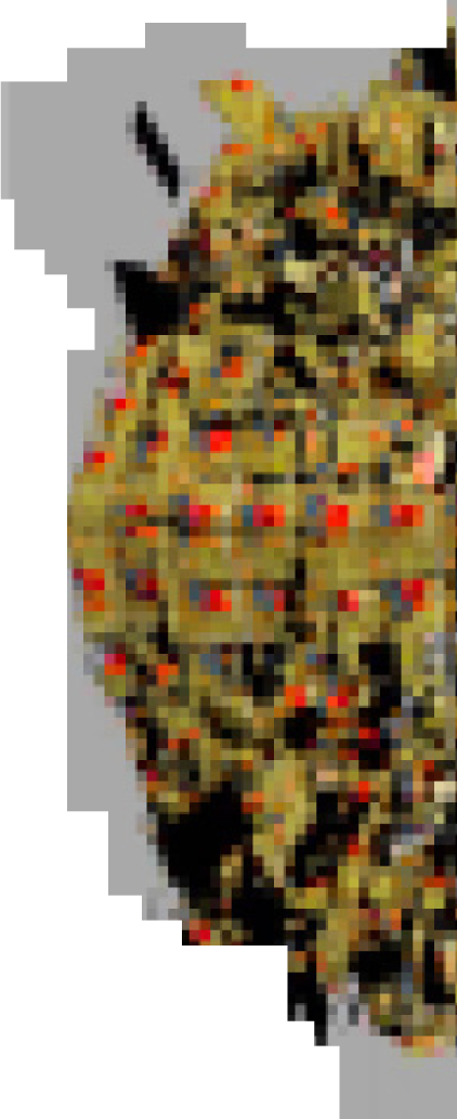
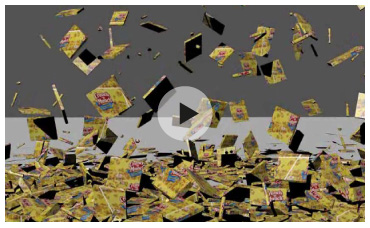
Artist Nicholas O’Brien digitally reconstructed ten demolished buildings in Omaha, Nebraska, from ConAgra products - the company that tore down the buildings. In this animation, a turn-of-the-century warehouse building by architect Thomas Rogers Kimball is rebuilt using “Crunch ’n Munch”, a ConAgra brand of caramel-coated popcorn and peanuts. (Video: Turbulance.org )
-
re-creation and prescient contemporary interpretation. As the result of a recent buyout in November 2012, the ConAgra corporation is poised to become the largest packaged food business in the US. Watching O’Brien’s cereal-box buildings collapse again and again is like watching the past collapse into the present. Press replay: the repercussions continue to cascade down. WeltraumpalastA more recent, prominent case of demolition with great political ramifications was the 2008 removal of Berlin’s iconic Palast der Republik (Palace of the Republic). The former parliamentary house of the GDR was itself built atop the bombed-out ruins of the Berlin City Palace, the former seat of the Prussian Monarchy. A symbol of socialism mounted atop a flattened symbol of imperialism, the palace’s destruction in the name of aesthetic progress and unity could not have been more heavily-laden.
For the project Weltraumpalast, Prof. Stefanie Bürkle (in collaboration with the German Aerospace Center) used an Eyescan panoramic camera to scan the interior space of the palace before its destruction, creating a 360-degree virtual footprint to outlast the architecture. In conjunction with the stereo imaging, an image of the building’s façade was printed as a pattern wallpaper, replicating the building’s exterior “skin” to be applied on any surface in the city.
In 2008, Berlin’s Bundestag claimed that the palace was too much of an eyesore and a symbol of political division to remain a worthwhile piece of architecture. In 1989, ConAgra officials argued that the economic revitalization the company would bring to Omaha trumped the importance of historic preservation. What is preservation really worth? What is lost along with a place?
-

Tuvalu Visualization Project Tuvalu is the fourth-smallest country in the world, with a population just over 10,000. Due to accelerating climate change, its land mass is slowly sinking into the Pacific Ocean – in the next 100 years, it may submerge too far to be habitable. Tuvalu Visualization Project, a joint research project of NPO Tuvalu Overview and Hidenori Watanave Loboratory at Tokyo Metropolitan University, has since 2008 attempted to document both the island’s diminishing geography and its endangered population.
The Tuvalu Visualization project archives snapshots of Tuvalu’s residents and geography, wich are tagged to Google Earth markers to provide a virtual tour of the island. Via a dialogue box, users can read about each resident and transmit messages to them online. The work is in some sense a preemptive memorial, a documentation in real-time that anticipates the island’s loss while providing a dynamic exchange with its present. By illustrating the intrinsic cultural links between the people of Tuvalu and their landscape, the visualization also connects the ever-more isolated Tuvaluans with the rest of the world, forging empathic links between remote populations through virtual means. Rather than typical news channels that foreground disastrous events on a quantitative scale, this aims for a different type of accuracy: that of human experience.
History is a creation of the present – a photograph is no less a simulacrum than a 3D rendering is. Memory is not about factual accuracy, it’s about the ability to situate oneself in the present through identification with the past. Approaches such as the Temporary Memorial Project for Jobbers’ Canyon, Weltraumpalast, and Tuvalu Visualization construct imagined, virtual connections in tandem with physical exactitude, visualizing the invisible architectures of political implications and human relationships for a complete and nuanced memorial of the lost. (ew)
(ew)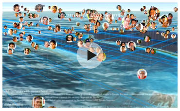
The Tuvalu Visualization Project archives the disappearing island of Tuvalu and its 10,000 inhabitants through photographic portraits of both people and places attached to GPS markers on Google Earth. (Video: NPO Tuvalu Overview + Hidenori Watanave Lab at Tokyo Metropolitan University, supported by Photon, Inc.)
-
Search
-
FIND PRODUCTS
PRODUCT GROUP
- Building Materials
- Building Panels
- Building technology
- Façade
- Fittings
- Heating, Cooling, Ventilation
- Interior
- Roof
- Sanitary facilities
MANUFACTURER
- 3A Composites
- Alape
- Armstrong
- Caparol
- Eternit
- FSB
- Gira
- Hagemeister
- JUNG
- Kaldewei
- Lamberts
- Leicht
- Solarlux
- Steininger Designers
- Stiebel Eltron
- Velux
- Warema
- Wilkhahn
FEATURED


-
Follow Us
Tumblr
New and existing Tumblr users can connect with uncube and share our visual diary.
»Intelligence starts with improvisation.«
Yona Friedman
Keyboard Shortcuts
- Skip Articles
- Turn Pages
- Contents